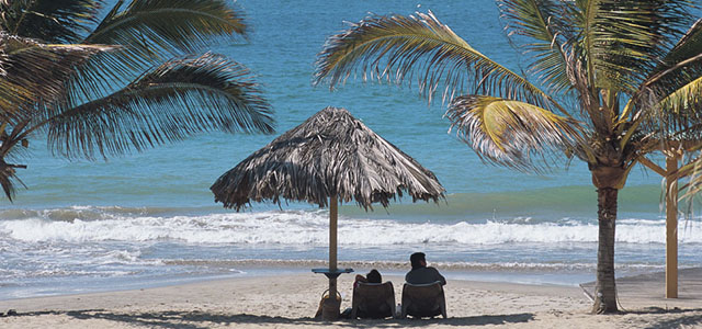
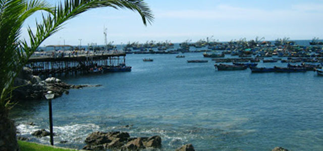
TUMBES
Location: The department of Tumbes is situated on the extreme northern coast of Peru.
Altitude: 5 masl (Aguas Verdes) Lowest town. 134 masl (Cañaveral) highest town.
Average annual temperature: 24ºC (38ºC maximum and 19ºC minimum).
Rainy Season: December to MarcH.
ACCESS ROUTES:
By land: Lima-Tumbes (1 270 km) along the North Pan-American Highway, approximately 18 h by car.
By air: Flights from Lima (about 1 ½ h).
PIURA

Location: The department of Piura is located on the coast, in the northern region of the country.
Altitude: 3 masl (Pita, Los Ãrganos) Lowest town. 2 709 masl (Ayabaca) highest town.
Average annual temperature: 24ºC (35,2ºC maximum and 16ºC minimum).
Rainy Season: January to April.
ACCESS ROUTES:
By land: Lima-Piura (1 035 km) on the Pan-American highway. The trips takes about 16 h drive.
By air: Daily flights from Lima with stopovers in the cities of Chiclayo and Trujillo (about 1 h 15 min).
LAMBAYEQUE

Location: The department of Lambayeque is located in the northern part of the country.
Altitude: 4 masl (Pimentel) Lowest town. 3 078 masl (Incahuasi) highest town.
Average annual temperature: 22ºC (33ºC maximum and 17ºC minimum).
Rainy Season: February to April.
ACCESS ROUTES:
By land: Lima - Chiclayo (770 km), about 10 hours' drive on the North Pan-American Highway.
By air: There are daily flights from Lima (about one hour).
TRUJILLO

Location: The department of La Libertad is situated in the north of Peru.
Altitude: 3 masl (Salaverry) Lowest town. 4 008 masl (Quiruvilca) highest town.
Average annual temperature: 18ºC (30ºC maximum and 16ºC minimum).
Rainy Season: June to August.
ACCESS ROUTES:
By land: Lima-Trujillo (561 km) - approximately 8 h by car along the North Pan American Highway.
By air: Daily flights available from Lima to Trujillo (approximately 45 minutes.).
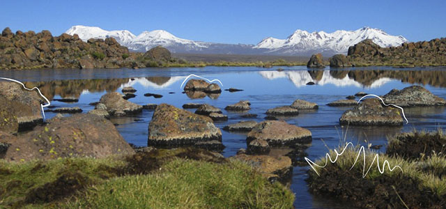
ANCASH

Location: The department of Ancash is located north of Lima between the Pacific Ocean and the Marañon River.
Altitude: 4 masl (Chimbote) Lowest town. 3 910 masl (Shilla) highest town.
Average annual temperature: It varies depending on the zone: 17ºC in the coastal zone and 7ºC in the highlands.
Rainy Season: In the coastal zone rain is unusual; however, in the highlands is from November to March.
ACCESS ROUTES:
By land: The most recommended is the Lima-Pativilca-Huaraz route (408km) about 7 hours drive. Other routes include: Casma-Huaraz (149 km) about 6 h 30 minutes drive.Santa-Huallanca-Huaraz (277 km) about 5 h 30 minutes drive.
By air: Non-regular flight services to Anta airport (Carhuaz). Flight takes approximately 35 minutes.
LIMA
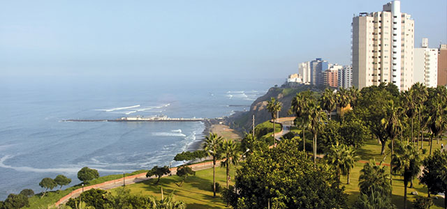
Location: The department of Lima is located in the central part of the country, comprising a coastal strip (facing the Pacific Ocean) and the highlands towards the east.
Altitude: 3 masl (Ancón) Lowest town. 4 278 masl (Tanta) highest town.
Average annual temperature: 19ºC (25ºC maximum and 13ºC minimum).
Rainy Season: There are no rains in Lima, the season with the highest humidity is winter which runs from June through September.
ACCESS ROUTES:
By land: Lima is linked by the Pan-American Highway with all the cities on the coast as well as with the coastal cities of Ecuador to the north and Chile to the south. The Central Highway, the Marginal Highway and penetration roads provide access to most cities over the highlands and the jungle.
By air: Lima is connected with the world's most important cities. It is the gateway to Peru's major destinations through Jorge Chávez International Airport.
ICA
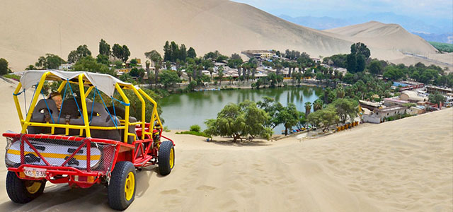
Location: The department of Ica is located in the central south coastal part of Peru.
Altitude: 2 masl (Paracas) Lowest town. 3796 masl (San Pedro de Huacarpana) highest town.
Average annual temperature: 20ºC (30ºC maximum and 8ºC minimum).
Rainy Season: Rain is unusual and it only happens during the El Niño phenomenon.
ACCESS ROUTES:
By land: Lima-Ica (300 km) on the South Pan-American Highway about 4 h drive from Lima.
By air: There is an air taxi service to Ica operating from Lima. Planes also overfly the Nasca Lines.?There are two airfields in the department of Ica:
. The airfield near Hotel Las Dunas, 5 km from Ica.
. The MarÃa Reiche Neuman Airfield at km 447 of the South Pan-American
Highway (Nasca).
AREQUIPA
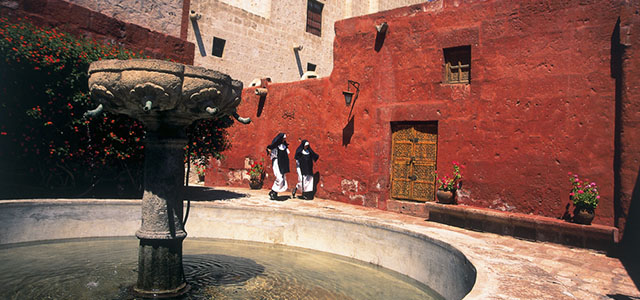
Location: The department of Arequipa is located in the south part of Perú on the Western Andes.
Altitude: 9 masl (Punta de Bombón) Lowest town. 4 525 masl (San Antonio de Chuca) highest town.
Average annual temperature: 20º C (24 º C maximum and 5 º C minimum).
Rainy Season: December to March.
ACCESS ROUTES:
By land: Lima - Arequipa (1 003 km) about 14 h drive.
By air: Daily flights depart from Lima (about 1 h approximately) and Cusco (about 30 minutes).
By railroad: There is a service that links Arequipa with the cities of Juliaca, Puno and Cusco.
MOQUEGUA
Location: The department of Moquegua is situated on Peru's southern coast.
Altitude: 15 masl (Ilo) Lowest town. 3 756 masl (Ichuña) highest town.
Average annual temperature: 22ºC (25ºC maximum and 17ºC minimum).
Rainy Season: January and February.
ACCESS ROUTES:
By road: Lima-Moquegua (1 144 km) along the South Pan-American Highway, about 16 h by car.
Arequipa-Moquegua (227 km) along the South Pan-American Highway, about 3 h by car.
Tacna-Moquegua (159 km) along the South Pan-American Highway, about 1 ½ h by car.
TACNA

Location: The department of Tacna is situated in the extreme south of Peru, on the border with Chile.
Altitude: 318 masl (Ite) Lowest town. 3 415 masl (Candarave) highest town.
Average annual temperature: 18,6ºC (22ºC maximum and 10ºC minimum).
Rainy Season: is unusual but the season with most humidity is from May to August.
ACCESS ROUTES:
By land: Lima-Tacna (1 293 km) on the South Pan-American Highway, about 18 h by car.
By air: Daily flights from Lima to Tacna (flying time about 1 h and 35 minutes).
CAJAMARCA
Location: The department of Cajamarca is located in the central north western highlands of Peru.
Altitude: 420 masl (Tembladera) Lowest town. 3 502 masl (Hualgayoc) highest town.
Average annual temperature: 14ºC (21ºC maximum and 5ºC minimum).
Rainy Season: December to March.
ACCESS ROUTES:
By land: Lima-Trujillo-Cajamarca (872 km) following the North Pan-American Highway and about 15 h car drive.
By air: There are daily flights from the city of Lima (about 1 h 10 minutes).
AMAZONAS
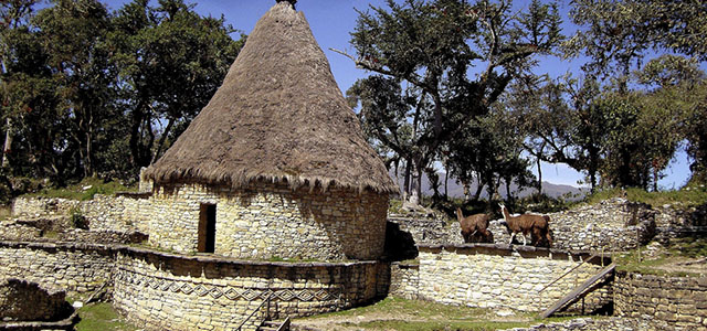
Location: The department of Amazonas is situated in the northeast of Peru.
Altitude: 230 masl (Santa MarÃa de Nieva) Lowest town. 3 952 masl (Chuquimbamba) highest town.
Average annual temperature: 15ºC (24ºC maximum and 18ºC minimum).
Rainy Season: December to March.
ACCESS ROUTES:
By land: The most advisable route is Lima-Chiclayo-Chachapoyas (1 225 km), about 24 hours by car. An alternative route is Lima-Trujillo-Cajamarca-CelendÃn-Chachapoyas (1 199 km), about 26 hours by car.
By air: Although there are no regular flights, it is possible to contract flights for groups from Chiclayo (for further information, contact perú, Tourist Information and Assistance). There are also non regular flights to Moyobamba and Rioja.
SAN MARTIN

Location: The department of San Martin is situated in the high jungle of northeastern Peru.
Altitude: 190 masl (Pelejo) Lowest town. 3 080 masl (Agua Blanca) highest town.
Average annual temperature: 24ºC (30ºC maximum and 15ºC minimum).
Rainy Season: December to March.
ACCESS ROUTES:
By land: There are two roads from Lima:
1. Lima - Chiclayo - Olmos - Bagua - Rioja - Moyobamba - Tarapoto (1 445 km) along the North Pan-American Highway and then branching off on the Marginal Highway. About 24 h by car.?
2. Lima - Huánuco - Tingo MarÃa - Tocache - Tarapoto (1 020 km) along the Central Highway and then branching off on the Marginal Highway. About 20 h by car.
By air: There are flights from Lima (flying time about 55 minutes); there is also an air taxi service within the region.
By river: The Huallaga river flows into the Marañon river, therefore it is used for river traffic connections with the Amazon area and neighboring countries.
HUANUCO
Location: The department of Huánuco is situated in Peru's central highlands.
Altitude: 167 masl (Honoria) Lowest town. 3 839 masl (Puños) highest town.
Average annual temperature: 20ºC (24ºC maximum and 18ºC minimum).
Rainy Season: December to March.
ACCESS ROUTES:
By land: The most advisable road is the Lima-La Oroya-Huánuco highway (410 km), about 8 h by car.
By air: Irregular service. Flying time is approximately 45 minutes.
PASCO
Location: The department of Pasco is situated in Peru's central highlands.
Altitude: 256 masl (Puerto Bermudez) Lowest town. 4 380 masl (Cajamarquilla) highest town.
Average annual temperature: 12,5ºC (22ºC maximum and 4ºC minimum).
Rainy Season: October to March.
ACCESS ROUTES:
By land: Lima-Cerro de Pasco (296 km) along the Central Highway (approximately 8 h by car).
JUNIN

Location: The department of JunÃn is situated in the middle of the Peruvian Andes.
Altitude: 313 masl (Puerto Prado) Lowest town. 4 505 masl (Morococha) highest town.
Average annual temperature: 13ºC (17ºC maximum and 0ºC minimum).
Rainy Season: November to March.
ACCESS ROUTES:
By land: The most advisable route is along the Central Highway from Lima to Ticlio and Huancayo (310 km), a 5 ½ h drive by car, crossing the Andes through the Anticona pass (Ticlio).
HUANCAVELICA

Location: The department of Huancavelica is situated in the central highlands of the Peruvian Andes.
Altitude: 1 900 masl (Ocoyo) Lowest town. 4 475 masl (Santa Ana) highest town.
Average annual temperature: 10ºC (20ºC maximum and 3.4ºC minimum).
Rainy Season: December to March.
ACCESS ROUTES:
By land: Several roads gain access to this city:
- Lima-Huancavelica (via Pisco 499 km) approximately 11 h by car.
- Lima-Huancavelica (via Huancayo 446 km) approximately 12 h by car.
- Ica-Huancavelica (346 km) approximately 12 h by car.
- Ayacucho-Huancavelica (via Rumichaca 244,9 km) approximately 6 h by car.
AYACUCHO
Location: The department of Ayacucho is located in the Central peruvian Andes, and it also covers some areas of jungle in the northwest of the departament.
Altitude: 1 800 masl (Otoca) Lowest town. 3 645 masl (Chalcos) highest town.
Average annual temperature: 17,5ºC (24ºC maximum and 11ºC minimum).
Rainy Season: November to March.
ACCESS ROUTES:
By land: The most recommended route is Lima - Pisco - Ayacucho (573 km), via Los Libertadores, with a duration of about 9 h by car. Other routes include: Cusco - Abancay Ayacucho (598 km) with a duration of about 19 h. Huancayo-Ayacucho (257 km) with a duration of about 6 h.
By air: There are flights from the city of Lima (about 45 minutes).
APURIMAC
Location: The department of ApurÃmac is located in the southeast part of the Peruvian central Andes.
Altitude: 2 378 masl (Abancay) Lowest town. 3 952 masl (Pataycampa) highest town.
Average annual temperature: 18ºC (25ºC maximum and 12ºC minimum).
Rainy Season: November to March.
ACCESS ROUTES:
By land: The most advisable route is Lima-Nasca-Puquio-Abancay (912 km), about 14 h by car. An alternative route is Lima-Huancayo-Ayacucho-Andahuaylas-Abancay (905 km) via Los Libertadores, about 22 h by car.
By air: Lima-Cusco (1 h flight) then by road on the Cusco-Abancay highway, about 7 h by car.
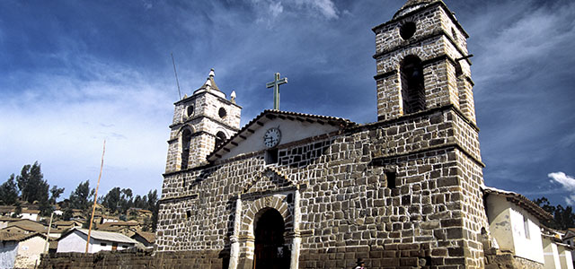
CUSCO
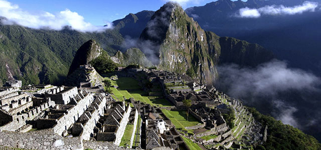
Location: The department of Cusco is located in the southeastern region of Peru.
Altitude: 532 masl (Pilcopata) Lowest town. 4 801 masl (Suyckutambi) highest town.
Average annual temperature: 11ºC (17ºC maximum and -02ºC minimum).
Rainy Season: November to March.
ACCESS ROUTES:
By land: The most recommended is the Lima-Arequipa-Cusco route (1 650 km). The trip takes about 24 h by car.?There is also another route from Lima-Nasca-Puquio-Abancay-Cusco (1 131 km). This trip takes about 26 h by car.
By air: There are daily flights from Lima to Cusco (about 1 h).
By railroad: There is a train service linking Cusco to the cities of Puno and Arequipa.?The trip along the Arequipa-Juliaca-Puno-Cusco route (735 km) takes about 17 h.
PUNO

Location: The department of Puno is located in the south eastern region of the county on the Collao plateau, on the shore of Lake Titicaca.
Altitude: 820 masl (lanlacuni bajo) Lowest town. 4 725 masl (San Antonio de Esquilache) highest town.
Average annual temperature: 8ºC (19ºC maximum and 2ºC minimum).
Rainy Season: December to March.
ACCESS ROUTES:
By land: The most recommended is the Lima-Arequipa-Juliaca-Puno route (1 302 km) which takes about 24 h drive.
By air: There are daily flights to Juliaca from Lima (about 1 h 45 minutes) and from Arequipa (about 45 minutes).
By railroad: Trains offer service from Arequipa to Puno (258 km and about 8 h) crossing the highlands at Crucero Alto (4 490 masl).
MADRE DE DIOS

Location: The department of Madre de Dios is located in the southeastern part of Peru comprising jungle territories.
Altitude: 183 masl (Puerto Maldonado) Lowest town. 500 masl (Boca Manu) highest town.
Average annual temperature: 26ºC (34ºC maximum and 21ºC minimum).
Rainy Season: December to March.
ACCESS ROUTES:
By land: The most recommended routes are as follows:
- Lima/Arequipa/Cusco/Puerto Maldonado (2 024 km). The trip takes about 44 h.
- Lima/Nasca/Abancay/Cusco/Puerto Maldonado (1 621 km). The trip takes about39h.
By air: There are routine flights from Lima (about 1 h 30 min) and Cusco (about 45 min).
By river: From Cusco to Paucartambo - Salvación by land, from Boca Manu-Colorado on boat along the Madre de Dios river to Puerto Maldonado, the trip takes about 4 days.
UCAYALI

Location: The department of Ucayali is situated on the left bank of the Ucayali river, in the mid-eastern jungle of Peru.
Altitude: 135 masl (Nueva requena) Lowest town. 350 masl (Esperanza) highest town.
Average annual temperature: 25ºC (38ºC maximum and 24ºC minimum).
Rainy Season: November to March.
ACCESS ROUTES:
By land: The most advisable route is Lima-La Oroya-Cerro de Pasco-Huánuco-Tingo MarÃa-Pucallpa (786 km), about 20 h by car.
By air: Flights available from Lima to Pucallpa (approximately 55 minutes.).
By river: The distance between Iquitos and Pucallpa by river is 1 021 km and the trip takes 4 to 5 days in winter and 6 to 8 days in summer, during the low water flow.
LORETO â IQUITOS

Location: The department of Loreto is located in the north-eastern region of Peru.
Altitude: 70 masl (Amelia) Lowest town. 220 masl (Balsapuerto) highest town.
Average annual temperature: 28ºC (36ºC maximum and 17ºC minimum).
Rainy Season: December to March.
ACCESS ROUTES:
By air: There are daily flights from Lima (1 h and 45 minutes flight). There is also service from the cities of Tarapoto and Caballococha.
By river: From port La Hoyada in Pucallpa (2,5 km from the city) it is possible to travel to Iquitos, by the Ucayali river, with stopovers in the Ports of Requena and Contamana.
There are two types of boats:
- Speedboat: small but speedy boat. The trip takes 2 to 3 days depending on the river stream.
- Chata: A large boat with a capacity to carry about 250 passengers but traveling at a Slow speed. The trip takes from 4 to 7 days depending on the river stream.